Univela 2025 a year of good wind for the community
20 November 2025
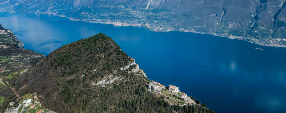
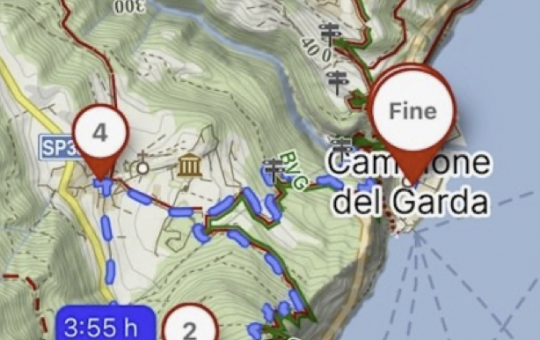
Setting out on foot from Campione del Garda means leaving the world of sails and the old industrial buildings of the former cotton mill and immediately entering the realm of rocky gorges, water carving its way through the mountain and sanctuaries suspended above the lake. Walking the Cammino di Montecastello uphill, from the lakeside village towards Tignale, is an itinerary that brings together nature and both industrial and Christian archaeology in a single story: penstocks, factory buildings, mule tracks, ancient bridges, hermitages and a sanctuary perched dramatically above Lake Garda.
Leaving the Univela area and the traces of the large factory that shaped the history of Campione, you follow trail 212 uphill along the slope until you reach the start of trail 110. The ascent begins right away with a steep flight of steps beside the stream. Here you can see at close range the intake works of the penstock, a tangible reminder of a time when the power of water drove turbines and looms.
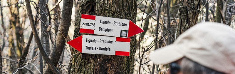
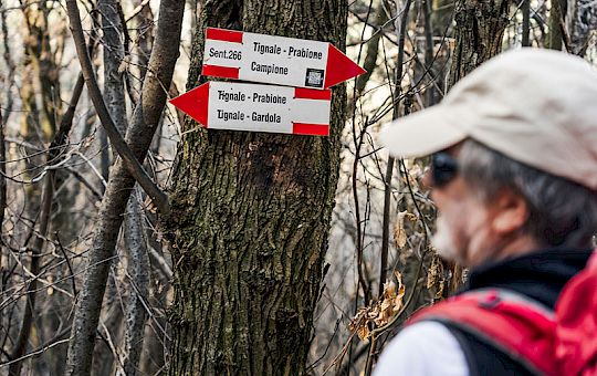
After this section you continue along trail 266 which, with about a dozen hairpin bends, quickly leads up to roughly three hundred and fifty metres in elevation. Behind you, the village of Campione becomes smaller and smaller, while in front of you ever wider views over the lake open up, taking in the Brescian and Trentino shores and the line of the mountains in the background.
The path then becomes less steep and more regular up to around five hundred and seventy metres, where the climb eases off among stretches of woodland, clearings and glimpses of the old mule tracks that once linked the villages. The gradient increases again in the final section leading to Monte Cas, a natural balcony that is perfect for a break, a few photos and a chance to refuel and recharge.
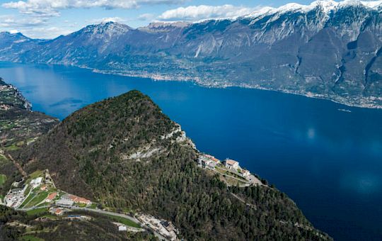
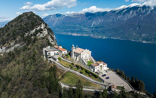
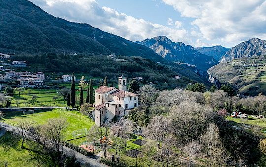
Just before and just after the summit you come across some of the most spectacular viewpoints of the whole hike. The view embraces the lake, the cliffs, the lemon groves and the lines of the historic roads that for centuries have stitched together the relationship between the hilltop villages and the small harbours on the shore. From here, with a final stretch along the ridge, you reach the Sanctuary of Montecastello in the municipality of Tignale, a true treasure chest of sacred art, once also a military stronghold and today a key landmark of Christian archaeology on the Garda.
After visiting the sanctuary, with its frescoes, former defensive positions and breathtaking views over Lake Garda, you descend towards Prabione. In this area the route enters the heart of the Alto Garda Bresciano Nature Park, among meadows, historic cultivated land and traces of a rural economy that once lived in balance with woods, pastures and small scattered settlements.
You head towards the wildlife observation point of the Alto Garda Bresciano Park Museum. It is an ideal place for a break, to enjoy a packed lunch surrounded by woods and meadows and, with a bit of luck, to spot deer, roe deer or birds of prey in flight. After the break, you continue along trail 204 until you once again meet trail 266, which you then follow in the opposite direction to return towards Monte Cas, the San Michele valley and finally the starting point at Campione.
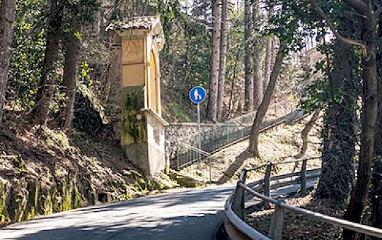
Those who want a day with even more hints of industrial and rural archaeology continue instead along Via Mazzini and then on the mule track marked as trail 204 in the so called Valle Scura. Here the landscape changes. The woods become denser, the light filters through in patches and the hike takes on the feel of an exploration, among old dry stone walls, stone structures and traces of hydraulic works.
The symbolic feature of this section is “El Pontesel”, an old stone bridge with two superimposed arches that links the two sides of the valley at a narrow gorge, dark and about forty metres deep. Crossing it is a small lesson in landscape archaeology. You can feel how essential this passage once was to connect communities, fields and pastures on the opposite slopes.
Beyond the Pontesel the path climbs again, gaining about two hundred metres in elevation on stretches that are sometimes steep, until it reaches the locality of Prione and Cadignano, where you stop for a packed lunch in a very peaceful setting among meadows and old rural buildings.

The return to Univela leads through the locality of Pregasio and then down the slope that drops steeply towards Campione. Here you follow the famous Sentiero delle Operaie, the workers’ trail, a equipped path that once linked the houses and villages higher up with the mill on the lake. This section is one of the most meaningful in terms of social memory. Imagining the female workers walking down and back up this trail every day turns the hike into a journey through the history of labour on Lake Garda as well as into a mountain outing.
With steps, short equipped sections and sudden viewpoints over the lake, the workers’ trail leads the hiker back to the imposing industrial building, the penstocks, the chimneys and the structures that today have been brought back to life for sports and tourism activities. The loop closes here, in which every section tells a different relationship between people, mountains, water and faith.
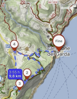
| Type of route | Circular route starting and ending in Campione del Garda |
|---|---|
| Difficulty | E, hiking level |
| Total distance | 9.8 kilometres |
| Starting elevation | 70 metres above sea level |
| Maximum elevation | 770 metres |
| Total ascent | 700 metres |
| Hiking time | About 4 hours of effective walking |
| Water on the route | Not available, you need to carry your own supply |
Given the elevation gain and the presence of steep sections, steps, bridges and equipped paths, it is important to tackle the Cammino di Montecastello with suitable equipment:
In this way, the route from Campione del Garda to Montecastello and back becomes much more than a simple hike. It is a route that invites you to read the landscape with different eyes, combining geology, nature and both industrial and Christian archaeology in a single day of walking between lake and mountains.


The ideal place for a holiday on Lake Garda, for nature lovers and for all sports enthusiasts.
